(Otherwise known as Guanaja)
Best of an island is once you get there—you can’t go any further. You’ve come to the end of things.
Agatha Christie
Story has it, the first European to set foot on Guanaja named it The Island of Pines because it was, well, covered with pine trees. That first person was none other than Christopher Columbus who stopped there on his fourth voyage. The story also says that it was there that the once famous but now infamous explorer first encountered cacao (chocolate). It amuses me that Europeans first discovered chocolate in Honduras and yet every time I travel there George wants me to bring some good chocolate.
Fortunately, the name Island of Pines didn’t stick and through the years it was called Guanaja or some version of that. The original natives came up with that name. Chalk one up for the natives!
Guanaja is generally referred to as one of the three Bay Islands, but actually there are eight islands and over 50 cays that make up the Bay Islands. The three islands generally referred to as the Bay Islands are Roatan, Utila and Guanaja and are about 45 miles off the mainland coast.
Roatan is the largest and most developed. It is about 48 miles long and 5 miles wide, and mountainous. Divers discovered its virtues first and it was—and still is–a diving mecca, but now cruise ships are stopping there, retired expats are building houses, and it has become quite crowded, noisy, and “touristy.” Roatan boasts an international airport with several major airlines making daily flights.
The smallest of the so-called three Bay Island is Utila. It is relatively flat and much of it is mangroves and there are few beaches. Utila is considered one of the cheapest places to learn to dive and it is where the backpacker crowd goes to dive and party.
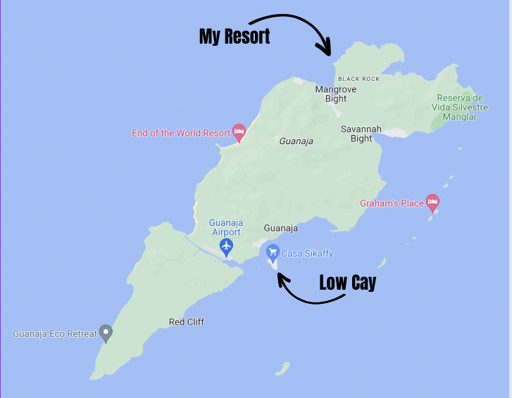
Then there is Guanaja. It boasts 19 square miles and is about 11 miles long, and, at its widest, just over 2 miles wide. It comes in as the second largest, or second smallest—take your pick. It is the most mountainous. As near as I can tell, there is only one flat spot on the island—the soccer field. Guanaja also has an airport (okay, 2 flat spots), and it’s not international; it’s barely inter-anything. It has no roads, no parking lot, but it does have a dock. One can only reach it by boat.
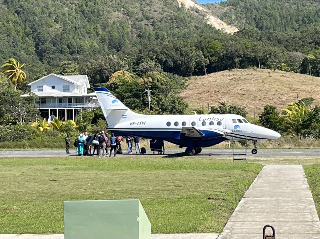
A unique feature about Guanaja is it is cut in half by a canal. It goes through a natural valley that cuts across the island. I don’t know when it was built or by who, but it was some time back. Low Cay sits off the east end, and on the west end is the bay where supposedly good ol’ Chris Columbus made his stop. The airport is alongside this canal.
Taking it in from a larger perspective, if you look at a map (a map? What’s that?). Okay. If you look at Google Earth you will see that the coastline of Mexico starting at around Cancun goes straight south. It continues south through Belize and it then hits a very small section of Guatamala where it turns left—east—and becomes Honduras. All of Honduras’ Caribbean coastline faces north (which becomes rather important when talking about hurricanes). So, as the crow flies, the Bay Islands are not too terribly far from the Belize Islands. They are worlds apart, however, when it comes to terrain. The Belize islands are flat– spits of sand really—whereas the Bay Islands are mountainous.
In my opinion, mountains are picturesque and the ocean is picturesque. Put them together and you have drop-dead gorgeous. That’s Guanaja. The terrain also makes it unlikely Guanaja will ever get over-developed.
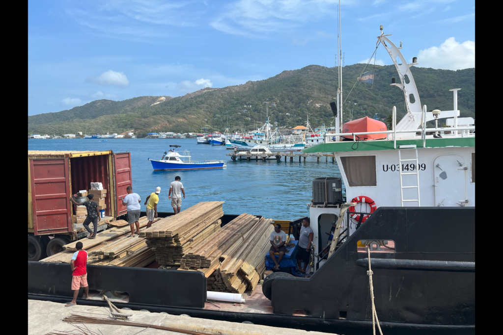
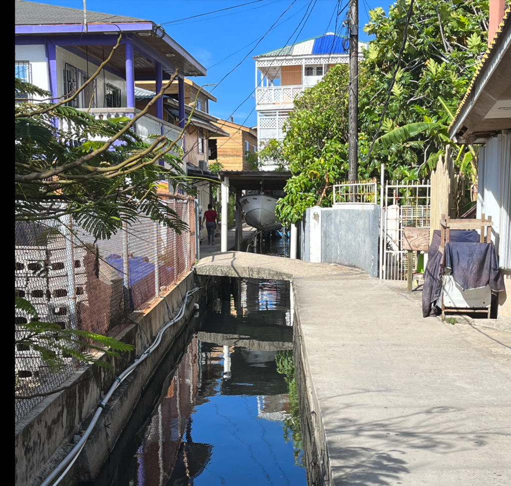
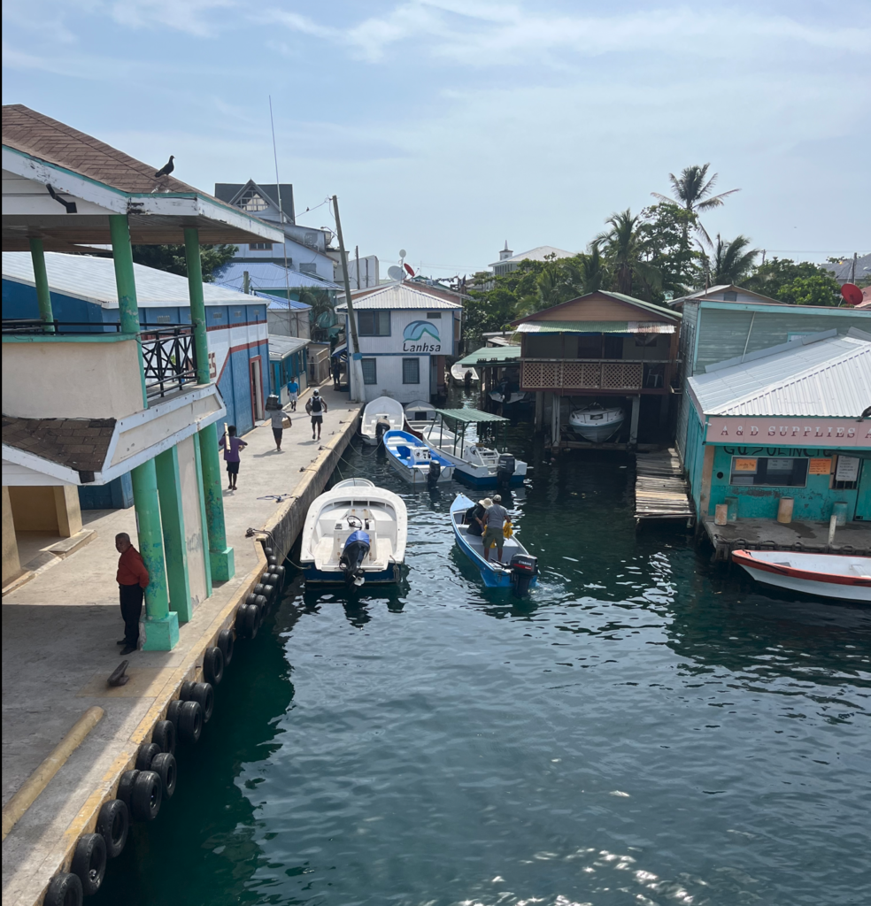
The east side of the island is the most populated and off that coastline are a string of small cays ( a cay is an itty-bitty little island) that range in size from maybe a half acre to a couple being as large as 15 to 20 acres. The largest and closest cay to the Guanaja shoreline is Low Cay. It is here where most of the people live (I don’t know why). It is a crowded little island—all buildings, houses, walkways, and waterways. I have seen no grass and very few trees. The waterways are canals of sorts and some refer to Low Cay as the Venice of the Caribbean and, I have to say, it is just like a very small, scrunched-up Venice. The municipal building is there; the only bank is there, which means the only ATM on Guanaja is there, the ferry from Roatan lands there, and all the freight boats bring their cargo there. It is a happening place.
With Honduras being a third-world country, I had expected Low Cay to be a crowded, dirty place with plenty of poverty. It isn’t. It is quite clean and I find it a fun place to hang out, especially on Thursday or Friday when the freight boats have unloaded supplies (fresh veggies anyone?). Low Cay has a definite small-town vibe.
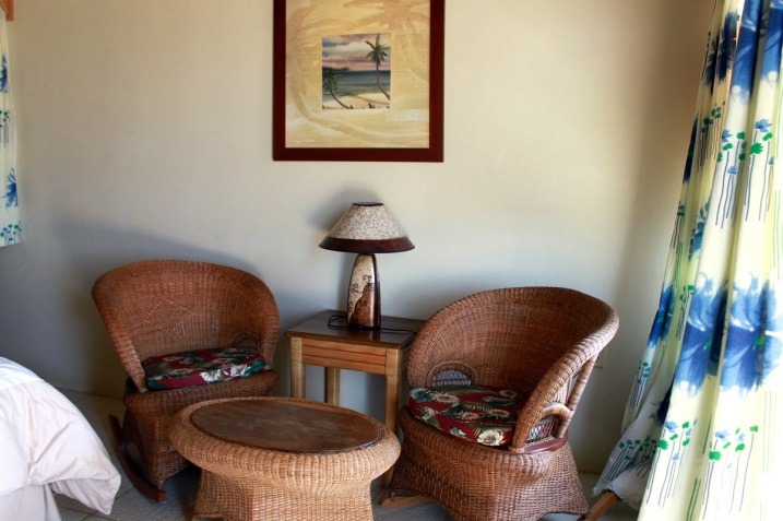
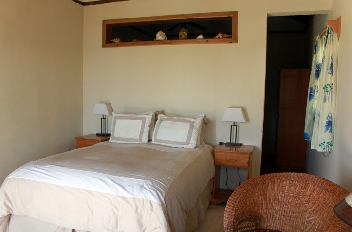
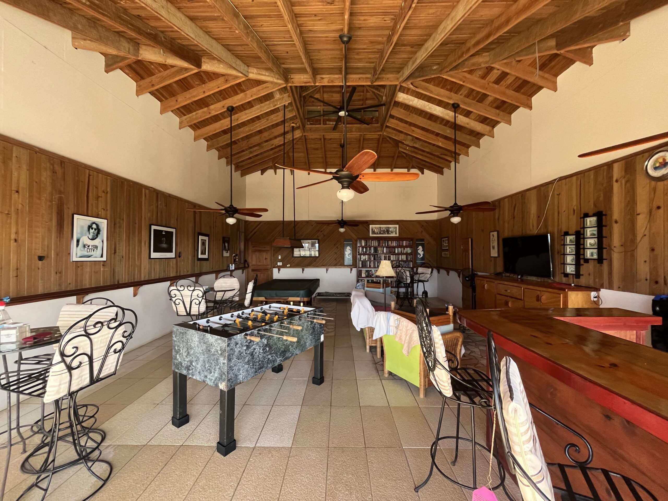
How many people live on the island? Try as I might, I can’t get a verified people count, but the number seems to be about 11 thousand. So, while most people live on Low Cay, there is Savanah Bight, Mangrove Bight, Northeast Bight (a remote fishing village without electricity or running water), and Sandy Bay. There also are people living on some of the other Cays, and a village called Brisas de Mitch—named after an infamous hurricane I will write about another time. There is a small community of old retired Gringos splattered around the island—generally in choice locations, and a few small dive resorts, only one of which is generating any sort of consistent business. I am hoping to make that two.
The native born and bred islanders speak English, or at least their version of it. The Bay Islands, like the Cays in Belize, were once held by the British. Plus, at some point, a large contingent of Cayman Islanders came to the islands along with pirates and more pirates many of whom spoke English. The English spoken on the island has morphed—like on other Caribbean islands—into a fascinating blend of English and unique island words and phrases. When two islanders are talking to each other, I cannot understand much, but it’s fun to listen to. When conversing with us gringos they’re perfectly capable of making themselves understood. As more mainland Hondurans move to the islands, Spanish has become dominant (just like Texas and California and….).
The island’s shape looks like an arrowhead with the tip pointed southwest (generally toward the mainland). Most of the people and development are on the southeast side, which is referred to as just the “east” side.”
On a typical island, non-tourist development is on the lee side of the island, which is the side facing away from the prevailing winds and current—for obvious reasons. But, on Guanaja, It seems to me the “east” side is the windward side and yet that’s where all the development is. I originally thought I wanted to be on the east side, assuming it was the lee side, because I’m not a fan of having my clothes blown off me on a regular basis. I have found the west/north side to be much calmer and generally just a much more pleasant side to be on. I am told that in December and January the island can get winds from the north that can switch that. I will take two months of wind versus ten months.
So, one might ask: What’s all the Guanaja hoopla about other than beautiful views, warm sea breezes, empty beaches, warm water, beautiful sunsets, and good fishing? It’s the diving and snorkeling silly!
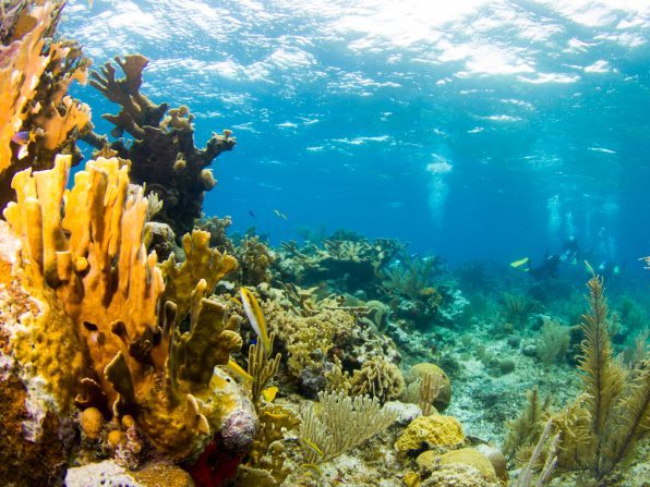
The Mesoamerican reef—second in size only to the Great Barrier Reef in Australia—stretches from Cancun Mexico to the Bay Islands. We are at the end of the reef—or if you stand on your head, we’re at the beginning. The island is surrounded by reefs. There are reefs, reefs, and more reefs. One cannot throw a hogplum into the ocean without hitting a reef. Combine that with clear warm water—no wetsuit for me—and very few divers you get spectacular diving. The reefs are (for now) virtually unspoiled and untouched. We often go diving and don’t even see another dive boat.
The reefs, however, present a challenge: Driving a boat. If you don’t know where you’re going or not paying attention you will probably lose a propeller and perhaps even your lower unit. There are reefs, patch reefs, mudflats, and big honkin’ rocks all lurking just underneath the surface waiting to take off your prop or lower unit.
To drive a boat, one must know where all this stuff is. I keep asking, where are the yellow and white lines, the turn lanes? How am I ever going to remember this stuff? And can we please order some extra boat-motor props? Like maybe a case of them?
On small islands, fresh water can be scarce and/or downright nonexistent. This is where Guanaja really shines. Up in the mountains are some fresh-water springs. The island boasts 3 waterfalls (that I know of) and several streams. I have heard—but not verified—that it is the only Bay Island with springs. Public water comes straight from the springs and it is great, drinkable water. But, I’m guessing, at some point, if the island gets a lot of development, people will have to supplement with rain catchment systems and such. For now, though, the water situation is pretty sweet (pun intended).
Okay, I am going to leave you with the following question. How many Caribbean islands have you visited where the island’s number one industry is not tourism?
Coming up next week is the gripping saga of Elizabeth, George and me trying to convince Laurie that buying a dive resort is a great idea. And, how Laurie and I land at Low Cay with Julia (the hurricane) in tow.
Island time is a real thing—slow and easy and it generally involves rum.—– (me)
#guanaja #diveresort #caribeanlife #retirement